Robust Positioning For  Track Geometry  Data
Add a New Dimension  to Geometry  Data
James Rome
Rome Navigation Innovations Inc.
James_Rome@uml.edu
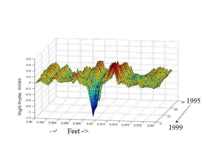
3-D Plot of Profile
We Have Developed A Package to Precisely Position 
Geometry Car Data. This is Currently Being Used By Amtrak

Data from one run to the next is lined up within a ft.

Geodetic positioning is generally better than that achievable
with GPS
, even if GPS is not available in the vicinity


Output of turn-key program is the same as input file , with Milepost and ft. Corrected.
That is, output is naturally compatible with existing applications using the data

It  Uses Geometry Data and  available GPS off  geometry cars ,and special
"Static Files" developed for the instrumented corridor


Position Corrected means:

1. Geometry Data on One Run Aligned  to Other Runs
       Data Aligned to about 1 ft.
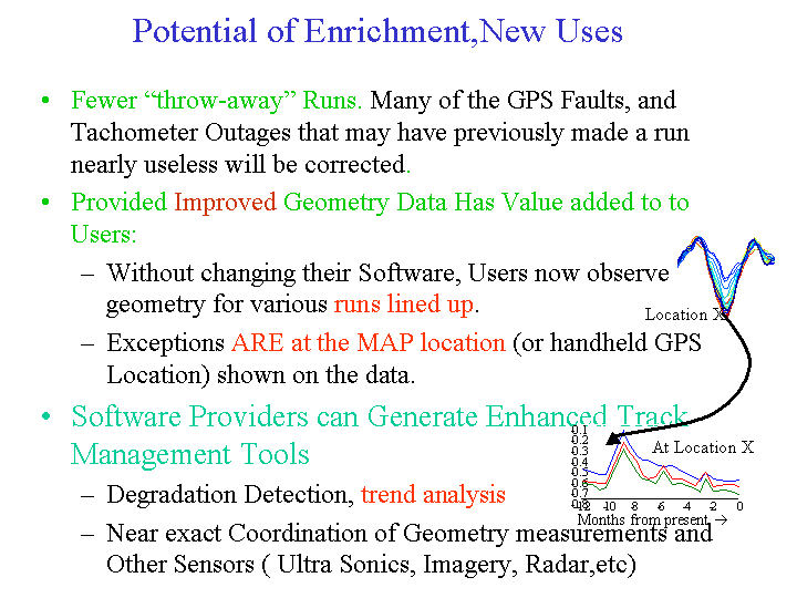
       Change and Trend Analysis is Easy

2. Locate  An Exception to Better than GPS Accuracy, Even if GPS
    is not available in area.  And Incredible Improvement in Availability
    of High Accuracy Geodetic Positioning:
Availability improvement

 
Fundamental Operation of the Process:

Input:

1. Static Files (click for explanation now)
2. Geometry Data off Car
3. GPS Data off car

Output:
1. Image of input geometry with  Milepost and ft Corrected
2. Quality Plots
3. Ancillray Files

Process: Technician Inputs Data, Stores output, See Figure.


                                     Explanation
                                    of static files
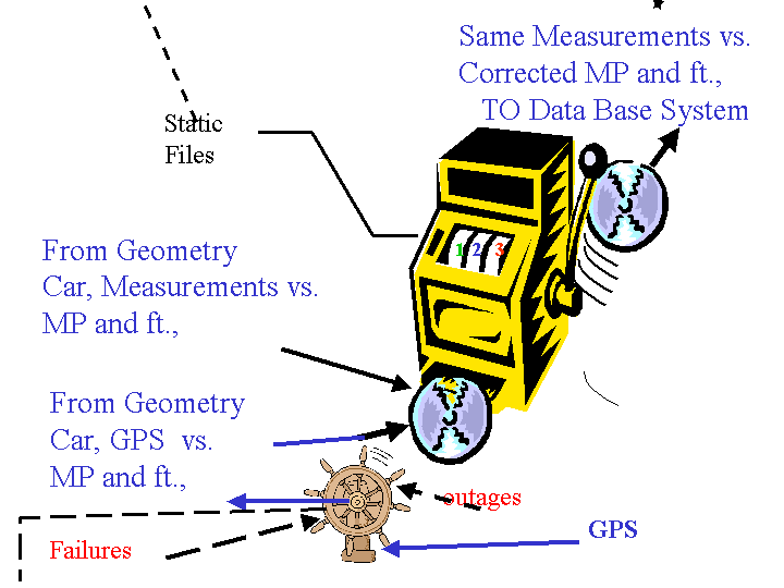
                       system config

                          Explanation of GPS Behavio
r


Example Results Shown Here:
 

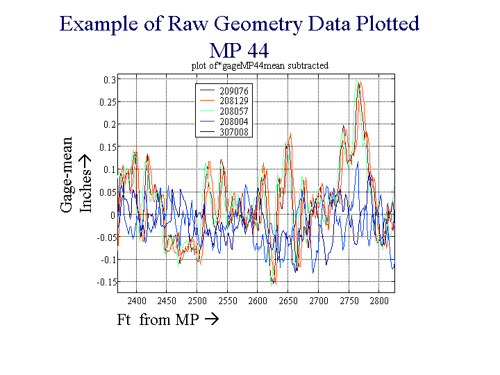
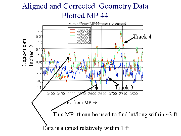
Plotted next are simple plots of Gage, vs. ft. for a given milepost.
For multiple runs eventually aligned by the program.

Actually data from two parallel tracks  are included here.
One, Track 3 is the "normal" Track, Track 4 is Alternate Track

First it is shown as the data is off the geometry car

Then a nearly identical file is shown after  position aligned, through program

First As The Data is off Geometry Car:


Off geomtery car

Data After Alignment, After Running the Program ( using same plotting program)

after alignment
Enrichments

         Learn more about the methods of positioning , and synergisms of approach      


         Learn More About Those Static Files

PERFORMING CHANGE DETECTION ANALYSIS WITH ALIGNED DATA

How is the Robust Positioning Process Run? Example of process

       How  Do we go about Getting this program capability

Another Application: Error Analysis of  Geometry Measurement system (powerpoint)


General Discussion of GPS Navigation and GIS  on  the Rails (powerpoint)