To Generate Track Map For Each Corridor
*Very accurately Place GPS from
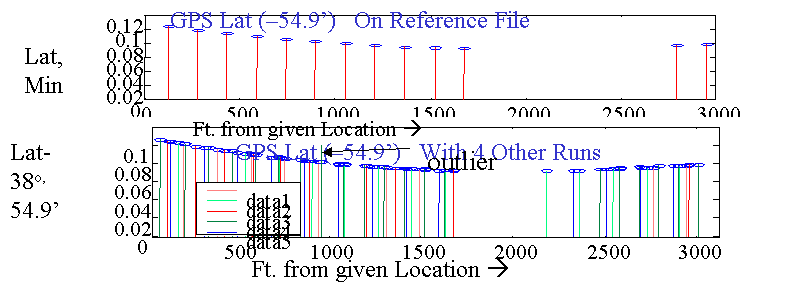
Reference run and GPS from other runs Aligned to
reference file onto a GPS
vs. Reference File odometer distance
* Use Robust outlier Elimination
*Apply Optimal
Smoothing of GPS Position vs. Distance ,using Odometer,
and "rate gyro" from curvature to precisely estimate LAT/Long, distance
along
track, and heading ( with about 1/2 the error as that from good,
standalone GPS).
Reconcile with existing surveyed
track map if available (not necessary) .In any case
you have a really good
track Map
for many purposes "for Free"
Generate a Master Milepost File